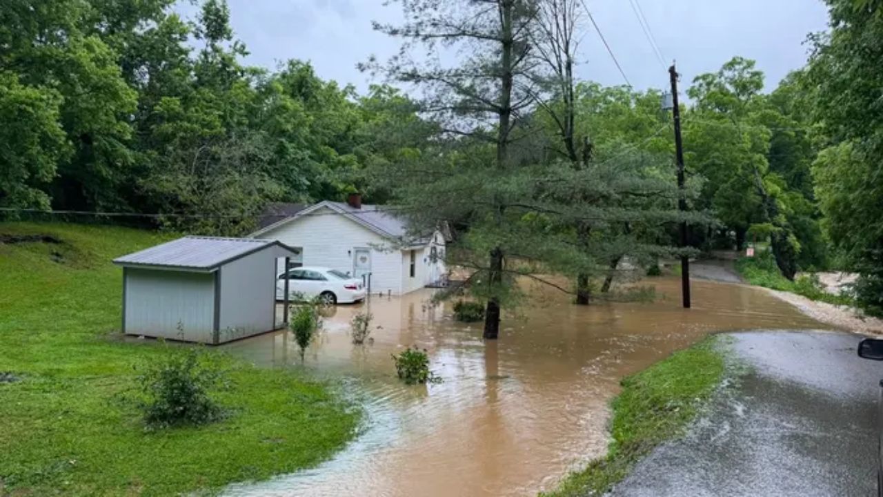
St. Louis, Missouri — Millions of Americans across the Heartland and the eastern United States are once again preparing for the threat of heavy rainfall and flash flooding as a slow-moving weather system is expected to bring repeated rounds of thunderstorms through the weekend.
Forecasters say the renewed storm threat comes just days after parts of the Upper Midwest experienced heavy rain and flooding. As a cold front continues pushing southeast, it will become the focus for widespread showers and thunderstorms stretching from the Mississippi Valley into the Ohio Valley, Tennessee Valley and eventually the Northeast.
Storm System Shifts Flood Threat Toward the Heartland and Ohio Valley
Weather experts expect storm activity to increase on Thursday across the Mississippi River Valley before expanding eastward into the Ohio and Tennessee Valleys on Friday.
A combination of abundant Gulf moisture, high atmospheric instability and a slow-moving cold front is expected to fuel repeated thunderstorms capable of producing torrential rainfall.
Meteorologists warn that winds running parallel to the front could allow storms to repeatedly move across the same communities, a weather pattern known as training thunderstorms, which significantly increases the risk of flash flooding.
Flash Flood Risk Could Increase in Several States
A Level 2 out of 4 flash flood risk has been issued for Thursday across portions of western Kentucky, southern Illinois and eastern Missouri.
By Friday, the threat is forecast to shift slightly east, with another Level 2 flash flood risk extending across parts of Ohio, Kentucky, Tennessee, Missouri, West Virginia and southwestern Pennsylvania through early Sunday.
Forecasters also caution that the Friday outlook could be upgraded to a Level 3 out of 4 if confidence continues to grow that slow-moving storms will repeatedly impact the same locations.
Residents in flood-prone areas are encouraged to closely monitor weather updates as forecasts evolve over the coming days.
Some Areas Could Receive Up to 5 Inches of Rain
Forecast models indicate widespread rainfall totals of 1 to 2 inches from southern and central Missouri eastward into West Virginia and northern Tennessee.
However, the greatest concern is for localized communities where thunderstorms repeatedly develop.
In those areas, rainfall totals exceeding 3 to 5 inches are possible, increasing the likelihood of flash flooding, especially in low-lying areas, along small streams and in urban locations with poor drainage.
Saturated Ground Raises Flooding Concerns
The renewed rainfall threat is particularly concerning because many communities have already received excessive rainfall in recent weeks.
Parts of Kentucky, Ohio and Tennessee continue to recover from late-June storms that saturated the ground and triggered dangerous flooding, including Flash Flood Emergencies in portions of Kentucky.
With little capacity for the soil to absorb additional rainfall, even moderate downpours could quickly lead to rapidly rising water levels and hazardous travel conditions.
Officials urge residents never to drive through flooded roadways, as floodwaters can rise rapidly and become life-threatening within minutes.
Northeast to See Rain Before Drier Weekend Arrives
While the most widespread heavy rainfall is expected across the Heartland and Ohio-Tennessee Valleys, the slow-moving front will also bring scattered showers and thunderstorms to parts of the Northeast, primarily on Friday.
Conditions are expected to improve over the weekend as high pressure builds behind the departing front, bringing cooler, sunnier and drier weather to much of the Northeast by Saturday evening and Sunday.
Until then, millions across several states should remain alert for changing weather conditions, especially in areas that have already experienced recent flooding.
Is your area expecting heavy rain this week? What preparations do you take when flash flood alerts are issued? Share your thoughts and experiences respectfully in the comments below.