Texas Gulf Coast — A massive cloud of Saharan dust that traveled thousands of miles across the Atlantic Ocean is now moving toward Texas, with forecasters expecting hazy skies and declining air quality to reach parts of the state in the coming days.
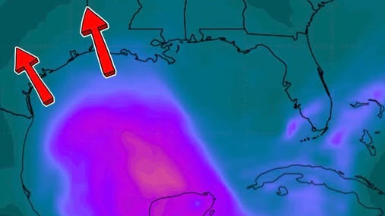
The dust plume has already spread across Florida and is forecast to continue moving west through the Gulf of Mexico before arriving along portions of the Texas Gulf Coast by early to midweek. The greatest impacts are expected from South Texas through the Houston-Galveston region, where the highest dust concentrations are forecast to arrive first.
When Will the Saharan Dust Reach Texas?
Meteorologists say the leading edge of the dust plume is already crossing the Gulf after arriving in Florida.
Current forecasts indicate coastal Texas could begin noticing hazy conditions by early to midweek, with skies becoming increasingly milky as the dust moves inland.
Communities along the Gulf Coast are expected to experience the most noticeable effects first, although lighter concentrations may spread farther inland depending on weather conditions.
What Is the Saharan Air Layer?
The dust is part of the Saharan Air Layer, a large mass of hot, dry, dust-filled air that forms over the Sahara Desert during late spring, summer and early fall.
Every year, intense heat and thunderstorms over North Africa lift enormous amounts of fine desert dust high into the atmosphere. Once airborne, the dust becomes trapped within this dry air mass and is carried westward by powerful trade winds.
During June and July, these dust outbreaks become especially common, allowing plumes to travel thousands of miles across the Atlantic before reaching the Caribbean, Gulf of Mexico and the southern United States.
What Texans Can Expect
Unlike a traditional dust storm, most people will not see dust falling from the sky.
Flood Threat Expands Beyond Texas as Possible Tropical System Could Drench the Southeast This Weekend
Instead, residents are likely to notice hazy or milky-looking skies, particularly during the day. The dust often creates brilliant orange and red sunrises and sunsets, making for dramatic views across the region.
However, higher concentrations of airborne particles can temporarily reduce visibility and lower air quality.
People with asthma, allergies, COPD or other respiratory conditions may experience increased irritation, coughing or breathing difficulties. Most healthy individuals are expected to experience little or no significant health impact.
Could the Dust Affect Hurricane Season?
While Saharan dust is known for creating colorful sunsets, it also plays an important role in tropical weather.
The Saharan Air Layer carries very dry air, which makes it more difficult for thunderstorms to grow and organize into tropical systems.
As a result, the dust can temporarily reduce the likelihood of tropical storms and hurricanes developing across parts of the Atlantic and Gulf of Mexico by increasing atmospheric stability.
Meteorologists note that this effect is generally temporary and does not prevent hurricanes from forming later in the season once the dust plume weakens or moves away.
With the Saharan dust cloud expected to reach Texas in the coming days, residents along the Gulf Coast may notice hazier skies, spectacular sunsets and changing air quality as one of nature’s most remarkable long-distance weather events makes its annual journey from Africa.
Have you noticed hazy skies or unusually colorful sunsets where you live? Share your photos and observations in the comments while remembering to take extra precautions if you have asthma or other respiratory conditions.