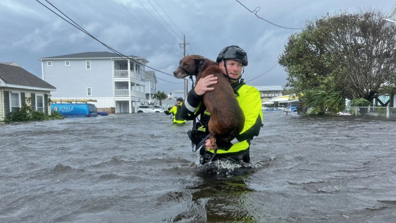
Norfolk, Virginia — Residents across parts of the Mid-Atlantic and the Carolinas are being urged to prepare for several days of heavy rainfall as forecasters warn that a surge of tropical moisture linked to Tropical Storm Bertha could significantly increase the risk of dangerous flash flooding.
According to the Forecasteras, a slow-moving weather pattern is expected to keep rounds of rain moving across the region through the end of the week, raising concerns for flooding in communities already dealing with unusually dry ground.
Tropical Moisture and Cold Front Create Flooding Setup
Meteorologists say the primary concern is flash flooding, as a cold front slows over the eastern United States while drawing deep tropical moisture northward from Tropical Storm Bertha and the Atlantic.
The combination is expected to produce multiple rounds of heavy rain, with storms repeatedly tracking over many of the same locations.
Unlike a fast-moving weather system, this setup could allow rainfall to accumulate over several days, increasing the likelihood of flooding in both urban and low-lying areas.
Drought Conditions Could Make Flooding Worse
Although parts of the Mid-Atlantic and Carolinas have experienced extreme to exceptional drought, weather experts say that does not necessarily reduce the flood threat.
Instead, parched, hardened soil often struggles to absorb large amounts of rainfall in a short period, causing water to run off quickly and increasing the risk of flash flooding.
Forecasters say this combination of drought and intense rainfall can create dangerous conditions, especially in areas with poor drainage, small streams and flood-prone roadways.
Residents are encouraged to remain alert, particularly if heavy rain develops over the same locations repeatedly.
Highest Flood Risk Targets Virginia and North Carolina
The Weather Prediction Center has placed portions of the region under a Level 3 out of 4 flash flood risk through Thursday, indicating a heightened potential for numerous flash flooding incidents.
The highest-risk area stretches from southeastern Virginia into North Carolina’s Outer Banks, where the greatest concentration of heavy rainfall is expected.
The flood threat is forecast to decrease slightly on Friday to a Level 2 out of 4, although meteorologists caution that the risk could increase again depending on how much rain falls during the first half of the week.
Bertha Intensifies in the Gulf: Warnings Issued as Florida, Alabama and Louisiana Face Storm Threat
As the cold front gradually shifts south, the heaviest rainfall is expected to move closer to the Atlantic coastline.
Several Inches of Rain and Strong Storms Expected
Cities including Norfolk, Virginia, and Wilmington, North Carolina, could receive 3 to 5 inches of rainfall through the weekend, with isolated locations potentially seeing even higher totals.
In addition to flooding, forecasters warn that repeated thunderstorms may produce damaging wind gusts, creating additional hazards for travel and outdoor activities.
Officials recommend monitoring the latest weather forecasts, avoiding flooded roadways and being prepared for rapidly changing conditions as heavy rain continues through the week.
With tropical moisture, saturated rainfall patterns and a slow-moving weather system all coming together, communities across the Mid-Atlantic and Carolinas could face one of the most significant flooding threats of the week.
Are you in an area included in the flash flood risk? What preparations are you making as heavy rain moves into your community? Share your thoughts and experiences respectfully in the comments below.