Austin, Texas — Large parts of Texas are preparing for another round of dangerous weather as slow-moving thunderstorms are expected to bring days of torrential rainfall, raising concerns about life-threatening flash flooding across much of the state.
Forecasters warn that some communities could receive a summer’s worth of rainfall in only a few days, with the greatest threat stretching from the Rio Grande Valley to southwest and central Texas through Thursday.
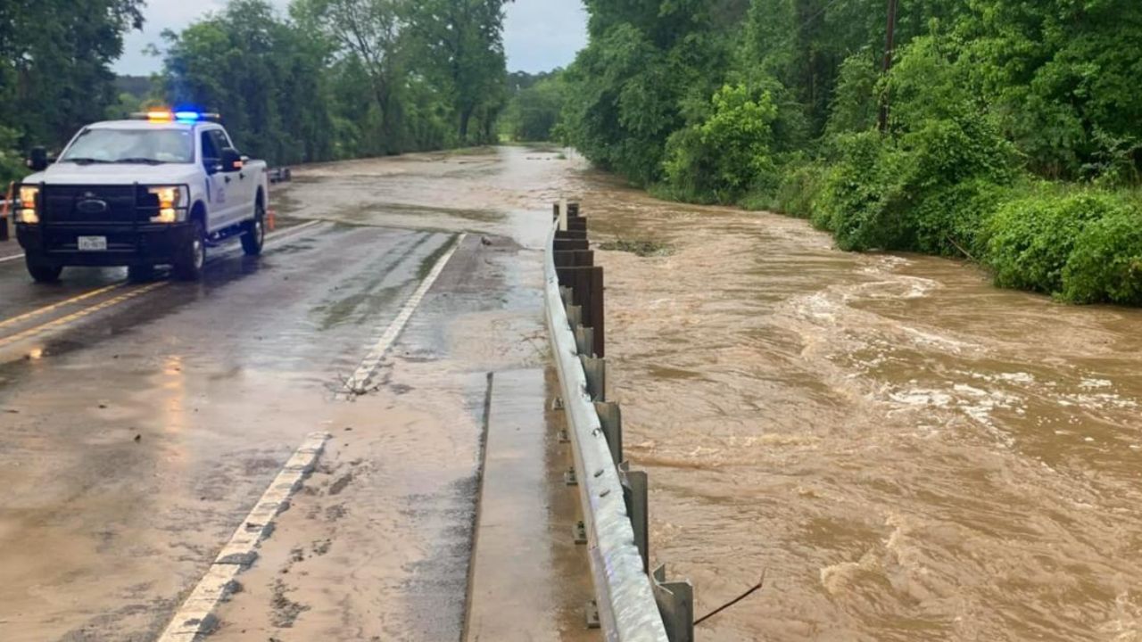
The developing weather system has already produced heavy rain in neighboring Louisiana, where intense downpours flooded roads and demonstrated how quickly conditions can deteriorate.
Millions Under Flood Watches Across Texas
Flood watches have been issued for nearly six million people across central and southwest Texas as the risk of flash flooding continues to increase.
Communities including Austin, San Antonio, Del Rio and San Angelo are among those being closely monitored, while localized flooding is also possible around Houston, especially during periods of intense thunderstorms.
Meteorologists say the greatest concern is not only the amount of rain expected but also how slowly the storms are moving, allowing repeated downpours to fall over the same locations.
Rainfall rates could reach 2 to 4 inches per hour, overwhelming drainage systems and causing creeks, rivers and low-lying roads to flood rapidly.
Some Areas Could Receive Up to 10 Inches of Rain
The highest rainfall totals are expected across parts of southwest Texas, particularly between Interstate 10 and the Rio Grande near the U.S.-Mexico border.
Forecast models indicate widespread totals of 2 to 6 inches, while isolated communities could receive as much as 10 inches of rain before the storm system weakens.
For places such as Del Rio, that amount would be close to what the region typically receives during the entire summer season from June through August.
Meanwhile, the Texas Hill Country is forecast to receive 1 to 3 inches of rainfall, although locally higher amounts remain possible if thunderstorms repeatedly develop over the same areas.
Officials Warn Residents to Stay Alert
With flooding becoming increasingly likely, Texas Gov. Greg Abbott activated the state’s emergency response over the weekend.
Water rescue teams, helicopters and other emergency resources have been placed on standby to assist communities if flooding worsens.
State officials are urging residents to remain cautious throughout the week, especially during heavy rain.
“Texans are urged never to drive or walk through flooded roadways, as floodwaters may be deeper and move more rapidly than they appear,” a release from the governor’s office said.
Emergency managers continue to encourage residents to monitor weather updates closely and prepare for rapidly changing conditions.
Texas Hill Country Remains Especially Vulnerable
The renewed flood threat comes just over one year after the devastating Fourth of July flooding in the Texas Hill Country, which claimed more than 130 lives, including children and counselors attending Camp Mystic.
The region is particularly susceptible to flash flooding because its steep terrain, shallow soil and exposed bedrock prevent heavy rain from soaking into the ground, causing water to run off quickly into creeks and rivers.
Meteorologists say the current weather pattern is being fueled by abundant Gulf moisture, a stalled weather front and atmospheric instability, creating ideal conditions for repeated rounds of slow-moving thunderstorms.
Although the flood threat is expected to gradually decrease by Friday or Saturday, forecasters say scattered showers and thunderstorms could continue across parts of West Texas into the weekend.
Are you in one of the areas under a flood watch? How are you preparing for the heavy rain? Share your thoughts and stay safe by following guidance from local emergency officials.