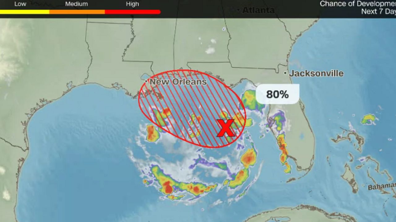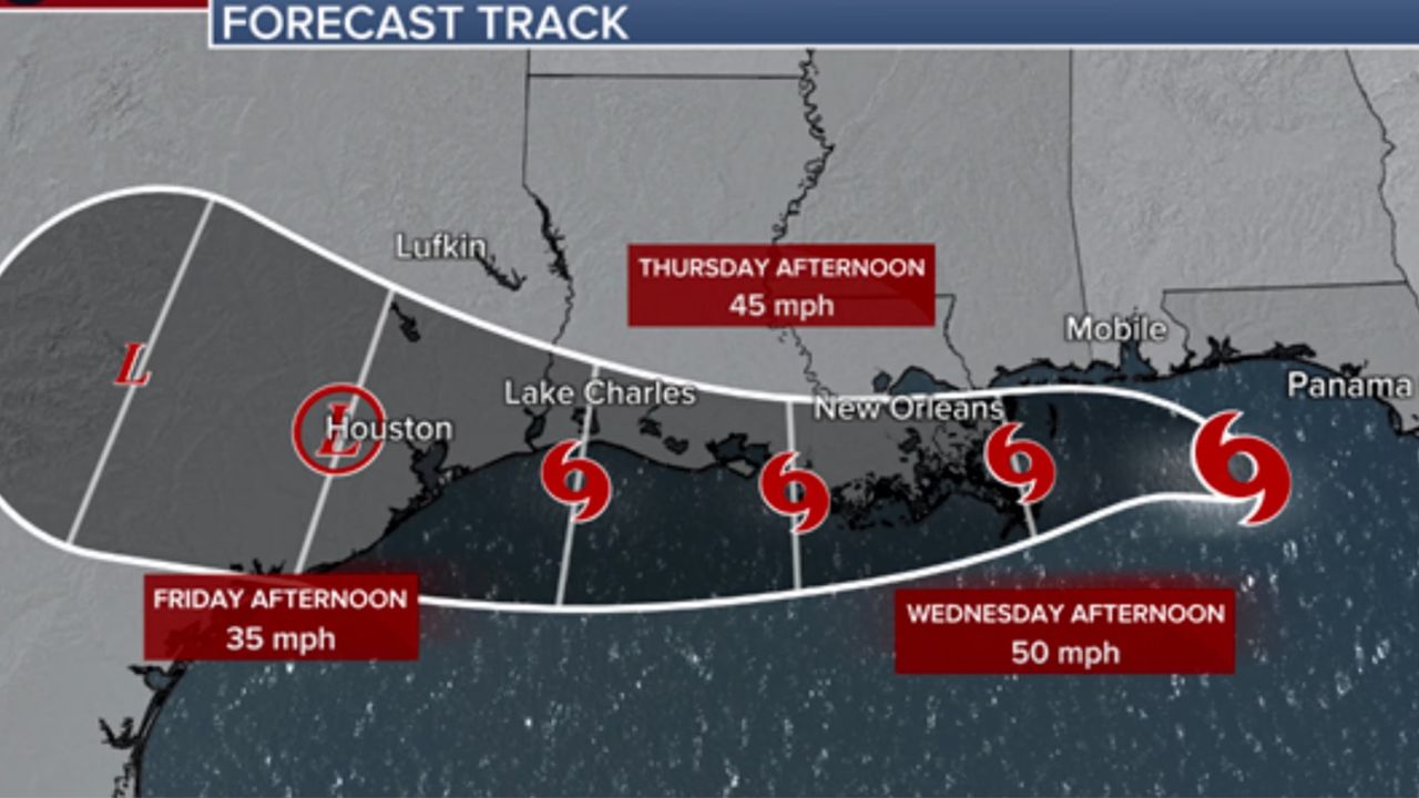
Panama City, Florida — Tropical Storm Bertha continued to strengthen Tuesday as it tracked across the northeastern Gulf of Mexico, prompting weather alerts across multiple Gulf Coast states where residents are being warned to prepare for heavy rain, strong winds, flash flooding and coastal impacts over the next several days.
According to the National Hurricane Center (NHC), Bertha’s maximum sustained winds increased to 60 mph, making it a stronger tropical storm as it approached the northern Gulf Coast. Although forecasters expect the system to gradually weaken later this week, officials say it still poses a significant threat to communities from Florida to Louisiana.
Bertha Expected to Track Along the Northern Gulf Coast
As of Tuesday evening, Bertha was moving west at approximately 6 mph through the northeastern Gulf of Mexico.
The National Hurricane Center expects the storm to continue moving westward or west-northwestward through Friday, keeping it near or along the northern Gulf Coast.
Forecasters say tropical storm conditions had already begun spreading across portions of the Florida Panhandle Tuesday afternoon, with additional impacts expected across western Florida, Alabama, Mississippi and Louisiana through Thursday.
While Bertha is not forecast to become a hurricane, meteorologists caution that slow-moving tropical systems can still produce dangerous weather, particularly prolonged heavy rainfall.
Tropical Storm Warnings Cover Large Portion of Gulf Coast
Weather officials have issued several alerts as Bertha approaches the coastline.
A Tropical Storm Warning remains in effect from the Bay/Gulf County line in Florida westward to Morgan City, Louisiana, including New Orleans and Lake Pontchartrain.
Meanwhile, a Tropical Storm Watch has been posted for areas west of Morgan City to Cameron, Louisiana, as well as Lake Maurepas.
Officials have discontinued the earlier Storm Surge Watch, but coastal communities are still being urged to closely monitor changing conditions.
According to the National Hurricane Center, tropical storm conditions are expected to develop within warning areas through Wednesday, while watch areas in Louisiana could also experience tropical storm conditions as the system moves west.
Heavy Rain and Flash Flooding Remain Biggest Concerns
Although Bertha’s winds have strengthened, forecasters continue to emphasize that flooding from heavy rainfall could become the storm’s most significant hazard.
Weather experts predict up to 6 inches of rainfall in some locations across the central Gulf Coast from western Florida through southern Louisiana.
The prolonged rainfall may lead to flash flooding, especially in low-lying neighborhoods, urban areas and locations with poor drainage.
In addition to heavy rain, Bertha could generate storm surge of up to 4 feet in some coastal communities, increasing the risk of localized coastal flooding.
Residents are encouraged to monitor local forecasts and be prepared for rapidly changing weather conditions over the next several days.
Second Named Storm of the 2026 Hurricane Season
Bertha is the second named storm of the 2026 Atlantic hurricane season, arriving just weeks after Tropical Storm Arthur made landfall along the Texas Gulf Coast in June.
Even though seasonal forecasts continue to call for a below-average hurricane season, meteorologists stress that individual storms can still produce dangerous impacts regardless of the overall outlook.
Emergency officials are reminding Gulf Coast residents to stay informed, review hurricane preparedness plans and avoid driving through flooded roadways if heavy rain develops.
Are you in an area expected to be impacted by Tropical Storm Bertha? How are you preparing for the storm? Share your thoughts and local conditions respectfully in the comments below.