New York City, New York — The first days of summer are bringing anything but typical beach weather to the Northeast, as a powerful weather system threatens to deliver heavy rainfall, flash flooding, and severe thunderstorms across some of the region’s most populated areas.
After a notably wet spring, millions of residents from Washington, D.C., to New England are once again dealing with unsettled weather as forecasters track a storm system capable of producing torrential rain and dangerous travel conditions.
Meteorologists say the combination of abundant Gulf moisture and a slow-moving weather pattern could create significant flooding concerns, especially along the heavily traveled Interstate 95 corridor.
Moisture-Rich Air Mass Fuels Heavy Rainfall Threat
The latest round of wet weather is being driven by a low-pressure system and an associated warm front moving eastward across the region.
As the system taps into deep tropical moisture from the Gulf, atmospheric conditions are becoming increasingly favorable for heavy rainfall.
Forecasters expect some areas to receive rainfall totals approaching 2 inches or more, significantly above what is typically observed during this time of year.
The atmosphere also contains unusually high moisture levels and a deep warm-cloud layer, creating ideal conditions for efficient rainfall production.
As a result, even short-lived storms could produce intense downpours capable of overwhelming drainage systems and flooding roadways.
Severe Storms Possible Across Major Northeast Cities
In addition to flooding concerns, portions of the Northeast face a risk of severe thunderstorms.
Weather experts say the position of the warm front will play a critical role in determining which communities experience the strongest storms.
Areas located south of the boundary could see thunderstorms capable of producing damaging wind gusts and isolated tornadoes. Cities such as New York City remain in a challenging forecast zone because the warm front may stall nearby.
When storms develop directly along a warm front, they often benefit from additional atmospheric lift, increasing the potential for stronger thunderstorms.
Even in areas that avoid severe weather, heavy rain alone could create hazardous conditions throughout the day.
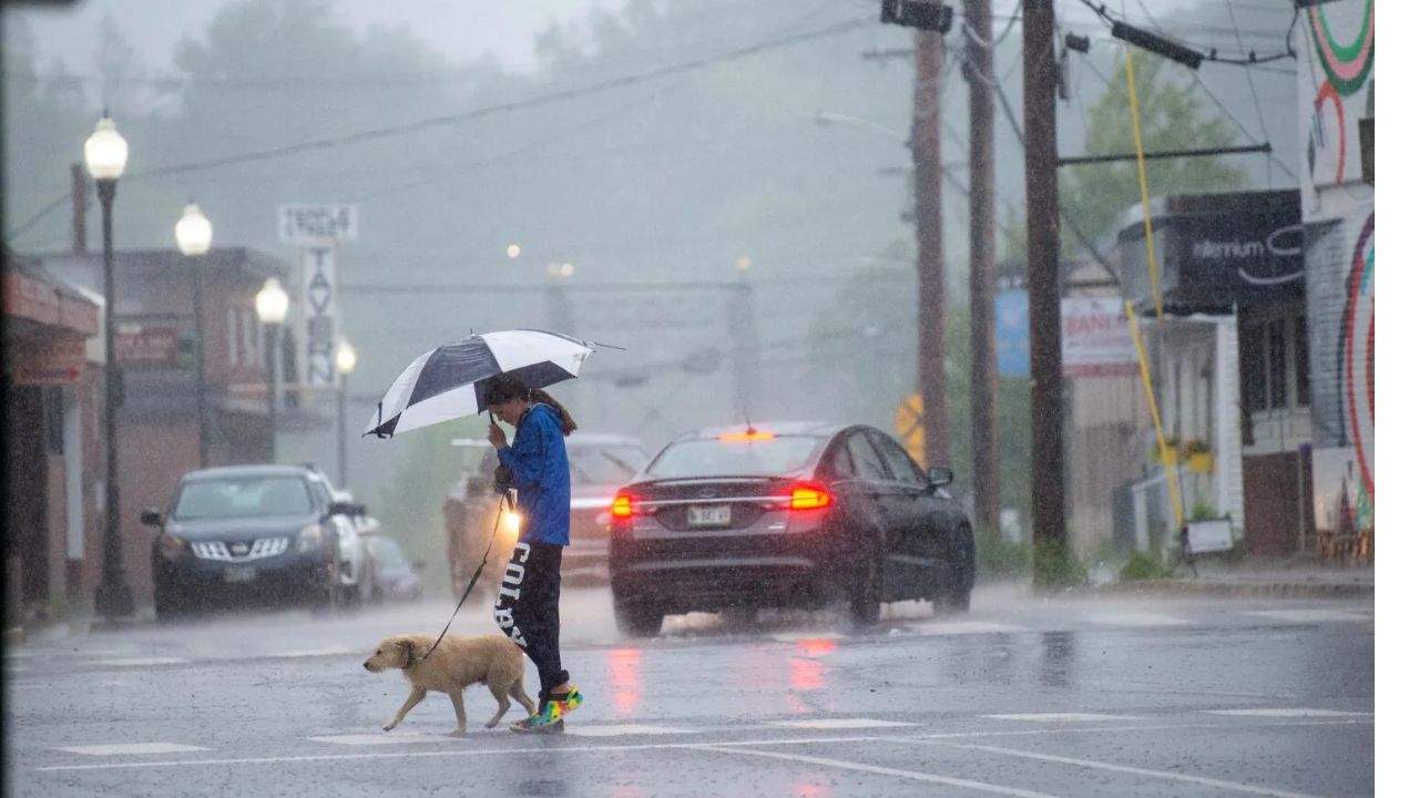
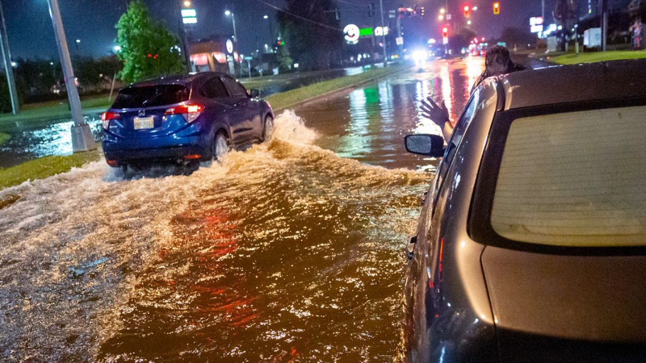
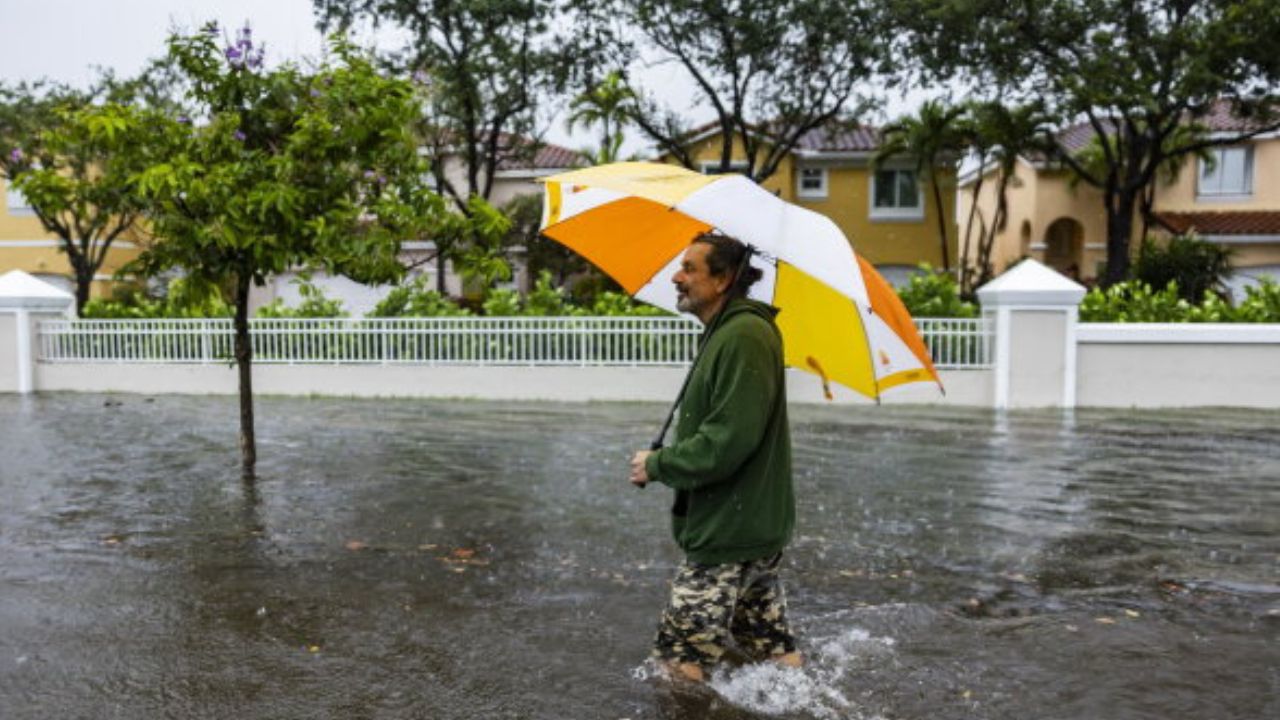
Flash Flood Concerns Increase Along I-95 Corridor
The biggest threat for many communities may be flooding rather than severe weather.
Because the atmosphere contains unusually high moisture levels, any thunderstorms that develop will be capable of producing significant rainfall in a short period of time.
Meteorologists warn that if storms repeatedly move over the same locations, localized flash flooding could develop rapidly.
A Level 2 out of 4 flash flood risk remains in effect through Tuesday morning across portions of the interior Northeast and New England.
Meanwhile, Flood Watches stretch along the I-95 corridor from Philadelphia to New York City, where urban flooding, ponding on roads, and travel disruptions are possible.
Residents are being urged to monitor forecasts closely and avoid driving through flooded roadways.
World Cup Events Impacted by Stormy Weather
The unstable weather has already disrupted several major events across the region.
In Philadelphia, officials closed the FIFA Fan Festival due to the threat of thunderstorms and heavy rainfall.
The NYNJ 2026 World Cup Fan Fest in Queens also suspended operations for the remainder of the day because of deteriorating weather conditions.
At one point, Philadelphia Stadium was temporarily evacuated approximately three hours before a scheduled World Cup match between France and Iraq as severe weather moved into the area.
The evacuation order was later lifted once conditions improved.
Additionally, a Severe Thunderstorm Warning affecting approximately 1.8 million people in the Washington, D.C., metropolitan area was issued before eventually expiring.
More Unsettled Weather Ahead
Forecasters say the stormy pattern is expected to continue through at least the middle of the week, prolonging what has already been an unusually wet start to the summer season.
With saturated ground conditions already present in many areas, it may take less rainfall than usual to trigger flooding concerns.
Residents throughout the Northeast are encouraged to remain weather aware, especially in flood-prone locations and areas vulnerable to rapidly changing storm conditions.
Have severe storms or flooding affected your area this summer? What preparations do you make when flood watches or severe weather alerts are issued? Share your thoughts in the comments below.