Denver, Colorado — Colorado is entering a potentially dangerous stretch of weather as forecasters warn that multiple rounds of severe thunderstorms could impact communities across the Front Range and Eastern Plains over the next several days.
Meteorologists say Tuesday may bring the most significant severe weather threat, with conditions favorable for powerful thunderstorms capable of producing large hail, damaging winds, and heavy rainfall. The unsettled pattern is expected to continue through at least midweek before a shift toward hotter and drier conditions increases fire weather concerns heading into the weekend.
Residents across much of eastern Colorado are being urged to closely monitor forecasts and prepare for rapidly changing weather conditions.
Tuesday Could Bring the Strongest Storms of the Week
Forecasters say a cold front moving through eastern Colorado early Tuesday will play a major role in setting the stage for severe weather.
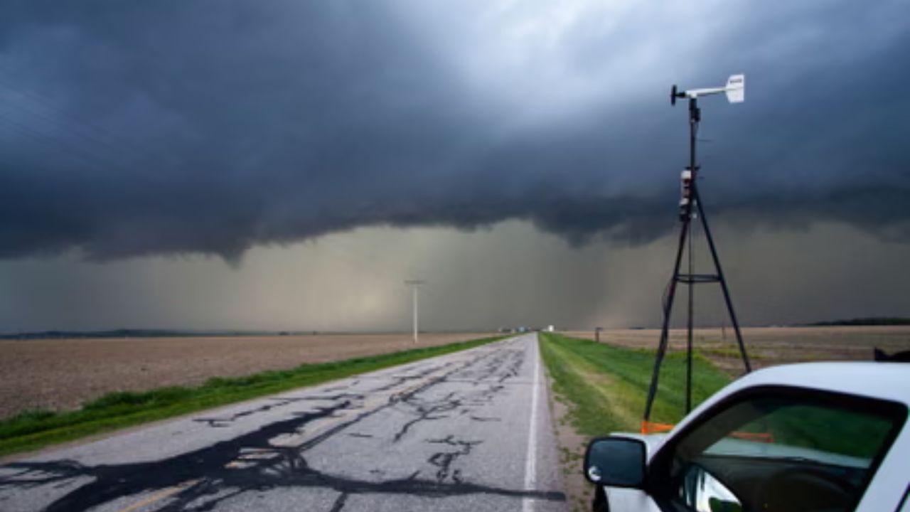
The front is expected to introduce cooler air and increase low-level moisture across the region. Combined with atmospheric instability and favorable wind patterns, those ingredients could support the development of supercell thunderstorms during the afternoon and evening hours.
Communities along the heavily traveled I-25 corridor could be among the areas most affected.
Cities facing the greatest risk include:
- Denver
- Boulder
- Fort Collins
- Castle Rock
- Other Front Range communities
Storms that develop may become intense quickly, bringing dangerous weather conditions to both urban and rural areas.
Large Hail and Damaging Winds Remain Major Concerns
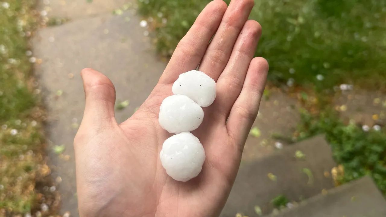
Weather experts warn that some storms could produce large hail capable of damaging vehicles, roofs, and property.
Strong wind gusts may also accompany the storms, creating hazardous travel conditions and the potential for downed trees or power outages.
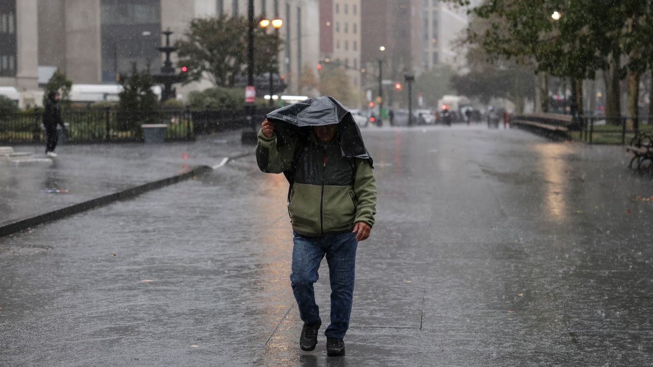
In addition to hail and wind, heavy rainfall could occur in localized areas where thunderstorms become slow-moving or repeatedly develop over the same location.
The combination of multiple severe weather hazards could make Tuesday one of the most active weather days Colorado has experienced in recent weeks.
Flooding Threat May Increase by Midweek
The severe weather pattern is expected to continue into Wednesday, bringing another round of thunderstorms to lower-elevation areas across the state.
While hail and damaging winds will remain possible, forecasters are increasingly concerned about the potential for flooding.
Moisture levels are expected to remain elevated for several consecutive days, creating conditions that could allow storms to repeatedly track across the same areas.
When that happens, rainfall can accumulate quickly and overwhelm drainage systems, leading to localized flash flooding.
The risk may be greatest across portions of the Eastern Plains, though flood-prone locations elsewhere could also experience issues if heavy rain persists.
Residents living near creeks, low-lying roads, and flood-prone areas should remain especially alert as the week progresses.
Severe Weather Could Continue Into Thursday
Forecast models suggest the threat of thunderstorms may linger into Thursday.
However, forecasters note that confidence in the exact timing and intensity of storms later in the week is lower compared to Tuesday and Wednesday.
Even so, additional strong storms remain possible before the weather pattern begins to change. Meteorologists will continue monitoring conditions closely as new forecast data becomes available.
Heat and Fire Danger Expected to Follow
Once the storm system moves out of the region, Colorado could quickly transition into a very different weather pattern.
Forecasts indicate that hotter and drier air may return by the weekend, increasing temperatures and raising concerns about wildfire danger in some areas.
The shift from severe storms to elevated fire weather conditions highlights the rapidly changing nature of Colorado’s summer climate.
For now, officials encourage residents to stay weather-aware and have multiple ways to receive alerts as severe storms move through the state.
How are you preparing for this week’s severe weather threat? Have you experienced hail or flash flooding during previous Colorado storm outbreaks? Share your thoughts and experiences in the comments below.