Houston, Texas — A major flood threat is unfolding across Texas and parts of the Gulf Coast this week as a slow-moving weather system combines with tropical moisture to produce rounds of heavy rainfall capable of triggering widespread and potentially life-threatening flooding.
Meteorologists are warning that conditions could worsen through Thursday as a disturbance near the Gulf Coast pulls in unusually high amounts of moisture for June. The system could even become the first named storm of the Atlantic hurricane season, adding another layer of concern for communities already dealing with saturated ground and rising water levels.
With flood watches stretching from Texas to Mississippi, officials are urging residents to remain alert as dangerous weather continues to develop.
Millions Face Risk of Significant Flooding
Flood watches have been issued for nearly 18 million people across parts of Texas, Louisiana, and Mississippi.
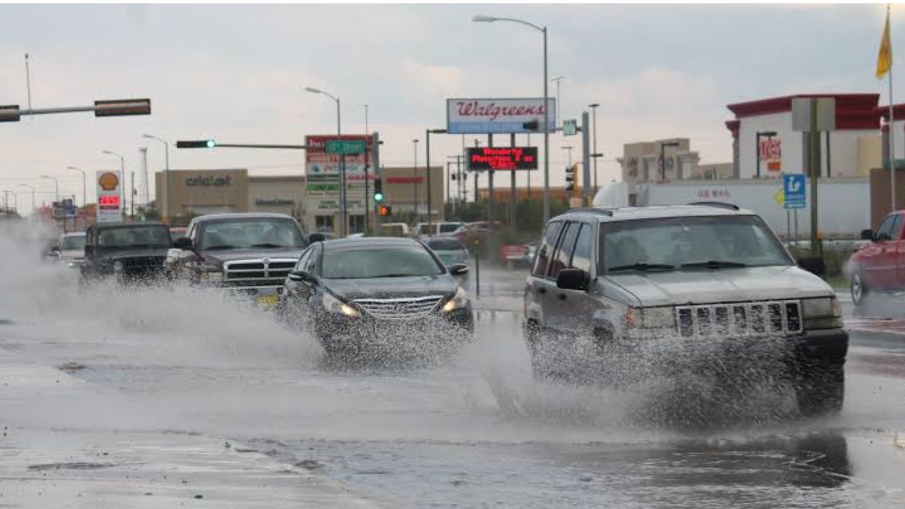
Cities including Houston, San Antonio, Brownsville, Lake Charles, and Jackson are among those facing the greatest risk of flash flooding during the multi-day event.
Forecasters say rainfall totals could reach 5 to 10 inches, with some isolated locations potentially receiving even more.
The Weather Prediction Center has issued a Level 3 out of 4 flash flood risk for portions of the region each day through Thursday, highlighting the seriousness of the situation.
Heavy rainfall rates could reach 3 to 5 inches per hour at times, increasing the likelihood of rapidly developing flash floods, especially in urban areas and locations that have already received substantial rainfall.
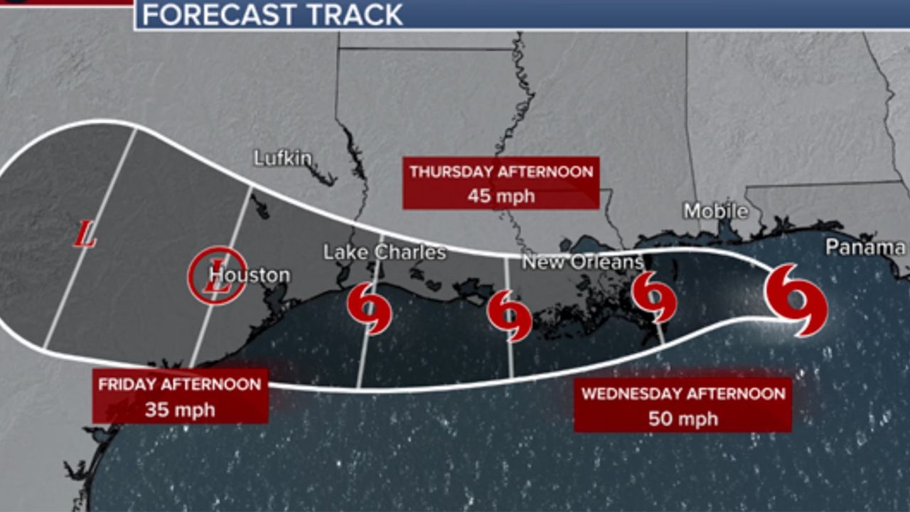
Potential Tropical Development Adds Concern
Part of the moisture fueling this event is linked to the remnants of former Tropical Storm Cristina from the eastern Pacific.
According to forecasters, there is a possibility that the disturbance could move into the northwestern Gulf and develop into a tropical depression or tropical storm.
If the system strengthens into a tropical storm, it would receive the name Arthur, becoming the first named storm of the Atlantic season.
Even if tropical development does not occur, meteorologists stress that the flooding threat will remain significant due to abundant moisture interacting with a stalled weather front across the region.
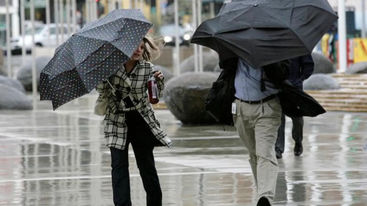
Coastal areas may also experience gusty winds and localized coastal flooding during the week.
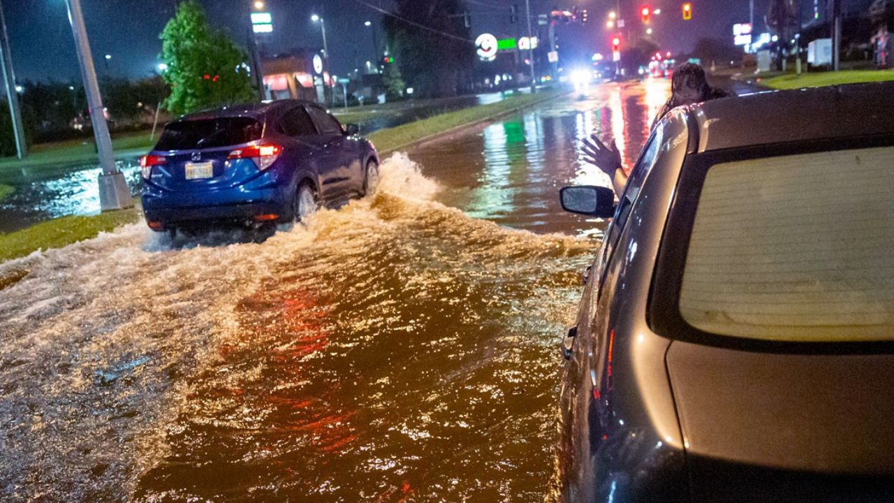
Water Rescues Already Taking Place
Flood impacts have already begun in several parts of Texas and Louisiana.
In response to the worsening conditions, Texas Governor Greg Abbott activated additional emergency resources to support local communities dealing with flooding.
Authorities reported numerous water rescues across central and south-central Texas as roads became inundated and vehicles became stranded.
In Bandera County, emergency crews launched a search after a vehicle was swept away by floodwaters early Monday.
Additional rescues were reported in Travis County, Williamson County, Bexar County, and the Waco area, where flooding left several vehicles trapped in rising water.
In Louisiana, emergency responders in Shreveport handled dozens of calls related to flooding after roads became submerged and water entered commercial buildings.
Officials say these early impacts may be only the beginning if heavy rainfall continues over the same areas throughout the week.
Flood Threat Expected to Shift Throughout the Week
Forecasters expect the highest flood risk to move across different parts of the Gulf Coast over the coming days.
Tuesday
Coastal Texas, southwest Louisiana, and portions of central Mississippi face the greatest flooding concerns. Heavy rain could also spread into parts of Alabama and Georgia.
Wednesday
The most dangerous flooding threat is expected near the upper Texas coast, including Houston and Galveston, where repeated rounds of rain could fall on already saturated ground.
Thursday
Southeast Texas, western Louisiana, northern Louisiana, and parts of Mississippi could experience the highest flood risk as tropical moisture continues streaming northward.
Friday
While details remain uncertain, forecasters say additional flash flooding could develop across portions of the South as another weather system pushes moisture farther inland.
Residents Urged to Stay Prepared
Emergency officials are encouraging residents in flood-prone areas to closely monitor weather updates and avoid driving through flooded roadways.
Flash flooding can develop rapidly, especially during periods of intense rainfall, and conditions may deteriorate quickly during the overnight hours.
With several days of heavy rain still ahead and the possibility of tropical development in the Gulf, communities across Texas and the Gulf Coast are being urged to prepare for potentially dangerous flooding conditions.
Do you live in an area affected by this week’s flood threat? What preparations are you taking as heavy rain moves through the region? Share your thoughts and experiences respectfully in the comments below.