Chicago, Illinois — Millions of Americans could soon be dealing with some of the hottest weather of the year as a massive heat dome develops across the nation’s midsection and spreads toward the East Coast ahead of the Independence Day holiday.
Forecasters say the prolonged stretch of heat and humidity is expected to build across the Plains, Midwest, Ohio Valley, Tennessee Valley, and portions of the East, creating widespread temperatures in the 90s while pushing heat index values above 100 degrees in some locations.
At the same time, powerful thunderstorms are expected to develop along the outer edge of the heat dome, bringing the threat of damaging winds, flooding rain, and possible severe weather outbreaks.
Heat Dome Expected to Expand Across Multiple Regions
Meteorologists expect the center of the heat dome to become established over the Ohio Valley, middle Mississippi Valley, and Tennessee Valley during the coming week.
As the weather pattern strengthens, hot air will expand outward into neighboring regions, affecting parts of the Great Lakes, Plains, Gulf Coast, and Northeast.
The result could be the most widespread stretch of 90-degree temperatures experienced so far this year across many Central and Eastern states.
Forecasters warn that intense sunshine combined with high humidity will make conditions feel significantly hotter than the actual air temperature.
RealFeel temperatures may climb to or above 100 degrees during afternoon hours, increasing the risk of heat-related illnesses, especially for those spending extended periods outdoors.
High Humidity Will Increase Heat Risks
Recent rainfall across many areas has left soil conditions unusually moist, contributing to elevated humidity levels.
While damp ground can temporarily limit temperature spikes, experts say temperatures could rise even further once the landscape begins drying out.
The combination of heat and humidity is expected to create dangerous conditions for vulnerable populations, including older adults, young children, and people without access to air conditioning.
Large metropolitan areas may experience additional challenges because urban environments often retain heat overnight.
As a result, nighttime temperatures may remain elevated, limiting opportunities for residents to cool down between hot afternoons.
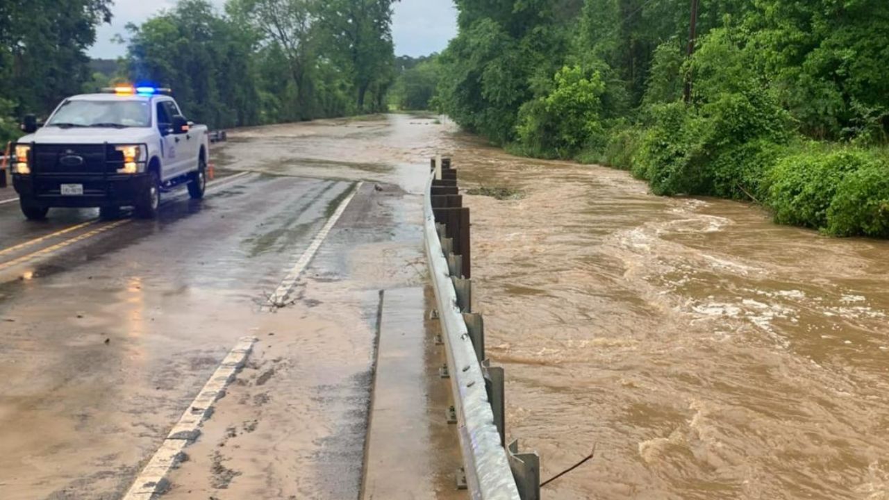
Severe Storms Could Develop Along Northern Edge of Heat Dome
While the core of the heat dome is expected to remain relatively dry, a very different weather pattern is likely to develop along its northern boundary.
Forecasters say repeated rounds of thunderstorms could track from portions of the Dakotas into the Upper Midwest, Great Lakes, and eventually parts of the Northeast.
Some of these storms could become severe.
Meteorologists are monitoring the possibility of large thunderstorm complexes capable of producing:
- Damaging wind gusts
- Flash flooding
- Large hail
- Crop damage
- Possible derechos
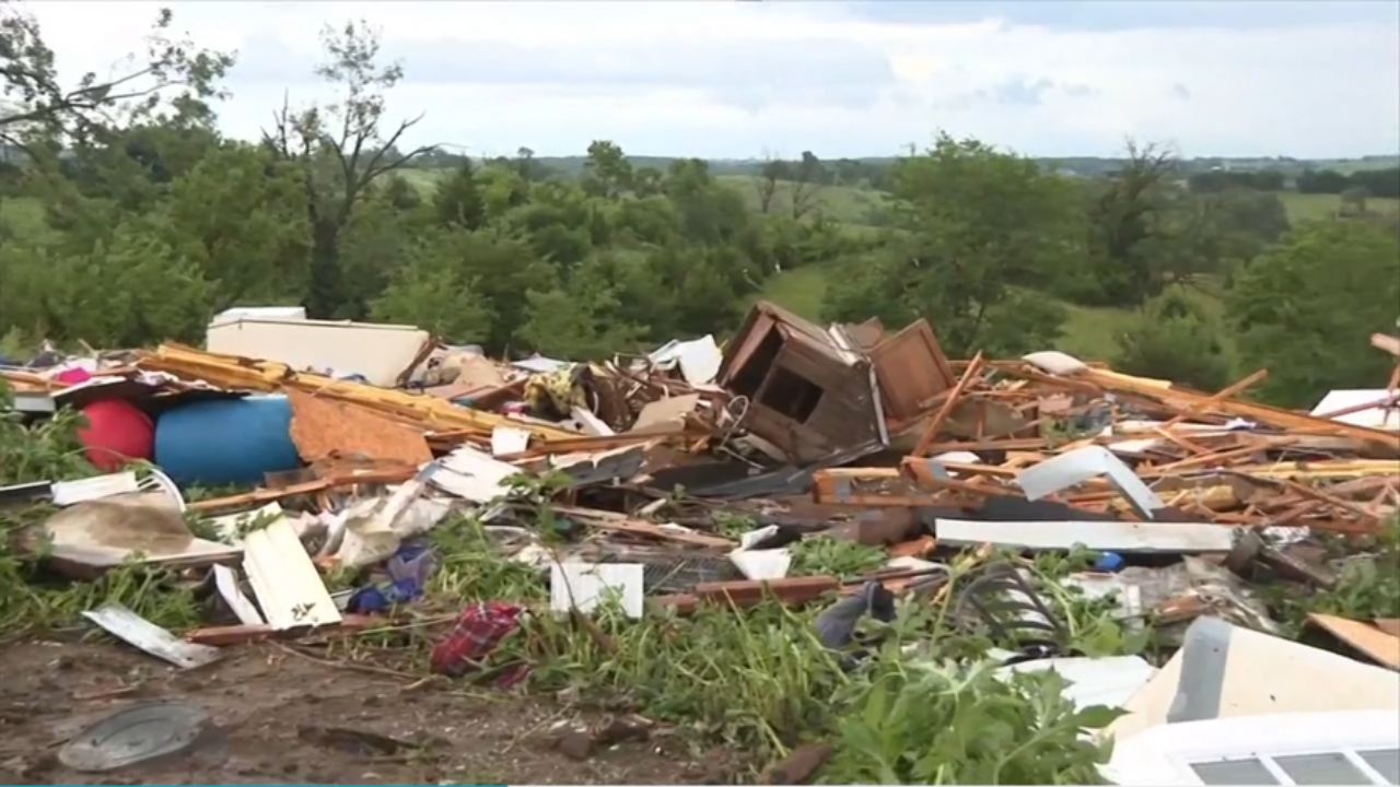
A derecho is a long-lived line of severe thunderstorms capable of producing widespread destructive winds over hundreds of miles.
Forecasters specifically warned that parts of Minnesota and neighboring states could face damaging storms similar to those experienced earlier this month.
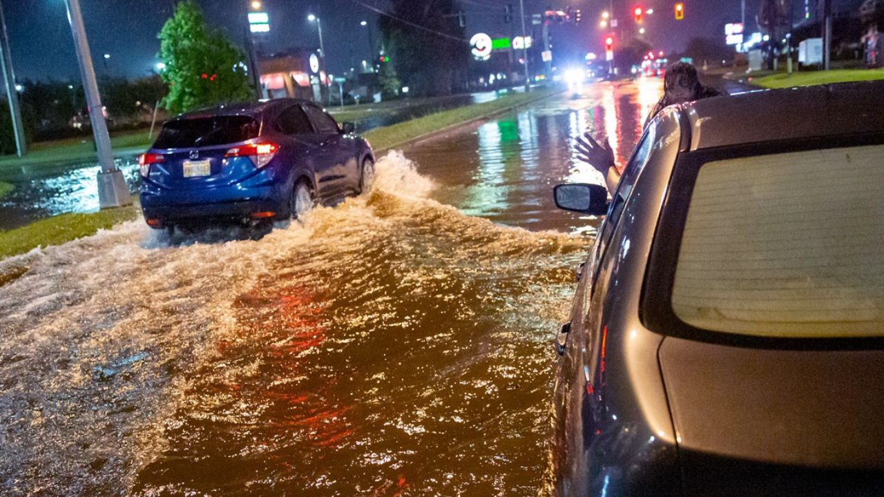
Northeast May Face Storm Threat Before Holiday Weekend
As the heat dome evolves, changes in the jet stream may push a strong weather system toward the northeastern United States.
Forecasters say portions of the Great Lakes and Northeast could experience strong thunderstorms capable of producing damaging winds and heavy rain in the days leading up to the Fourth of July holiday weekend.
The timing could potentially affect outdoor celebrations, travel plans, and holiday events in some communities. Residents are encouraged to monitor local forecasts as the holiday approaches.
Heat May Shift West Later in July
Although temperatures may gradually ease across parts of the Midwest during the second week of July, experts expect above-average warmth to continue across many areas.
Long-range forecasts suggest the core of the heat could eventually shift toward the Rockies and Intermountain West. That pattern could increase drought concerns and elevate wildfire risks across portions of the western United States.
Forecasters also note that smoke from potential wildfires could eventually affect air quality farther east, including parts of the Plains and Midwest.
What Residents Should Do Now
With both dangerous heat and severe storms possible, officials recommend preparing early by staying hydrated, limiting outdoor activities during peak afternoon heat, checking on vulnerable family members, and keeping weather alerts enabled on mobile devices.
While the weather pattern will bring risks, it will also deliver classic summer conditions for many communities planning cookouts, vacations, pool days, and Independence Day celebrations.
Are you expecting extreme heat or storms in your area before the Fourth of July? How are you preparing for the holiday weather? Share your thoughts in the comments below.