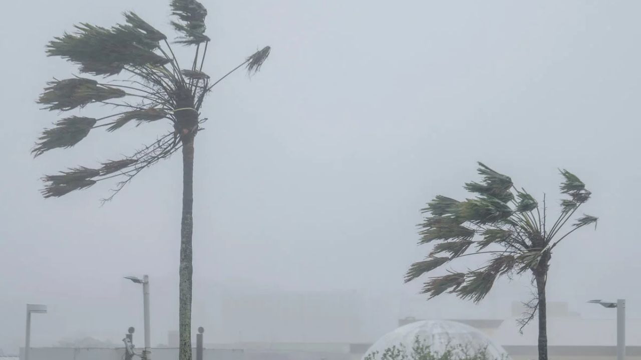
Rota, Northern Mariana Islands — Super Typhoon Bavi unleashed destructive winds and torrential rain after making landfall on the U.S. island of Rota, prompting emergency officials to warn residents of catastrophic damage and life-threatening conditions as the storm continued its path across the western Pacific.
The powerful cyclone struck the island Monday morning, bringing maximum sustained winds of up to 180 mph, making it equivalent to a Category 5 hurricane. The National Weather Service said the western eyewall passed directly over Rota, with the entire island briefly located inside the storm’s eye.
With a population of roughly 1,500 people, Rota faced the full force of one of the strongest tropical systems of the year.
Powerful Winds Leave Destruction Across the Island
Before the storm reached land, forecasters warned that a direct hit could leave much of the island uninhabitable for weeks or even longer.
Officials said many non-concrete and non-reinforced homes were at risk of total roof failure and wall collapse, while widespread damage to trees, utility poles and power lines was expected.
As the typhoon moved across the island, residents began reporting extensive damage.
According to local officials, a communications tower collapsed, knocking out portions of the island’s cellular service, while heavy winds and flooding continued throughout the day.
“We are hanging in there. We are experiencing heavy winds and flooding here,” said Lou Rosario, public information officer for the Rota Municipal Operations Centre.
Emergency Warnings Issued Across Guam and Northern Marianas
Typhoon warnings remained in effect not only for Rota but also for Guam, Tinian and Saipan, while nearby islands remained under tropical storm watches and warnings.
Meteorologists warned residents to remain indoors and avoid windows as dangerous flying debris, fallen utility poles and downed power lines created serious hazards.
“Entering outside can result in death from flying projectiles. Utility poles and associated power lines will be down,” National Weather Service meteorologist Edwin Montvila warned. “All those would pose a risk to life, so we recommend people to not venture out and hunker down.”
Guam Governor Lou Leon Guerrero also urged residents to stay inside their homes or emergency shelters until conditions improved.
Storm Expected to Remain Extremely Powerful
Although meteorologists said Bavi was moving at a relatively fast pace, they cautioned that its enormous size would continue producing damaging winds, torrential rainfall and dangerous conditions well after the eye passed.
The Joint Typhoon Warning Center forecasts that Super Typhoon Bavi will maintain its intense strength as it tracks west-northwest toward the Philippines, with the possibility of approaching Taiwan later this week.
A tropical cyclone is officially classified as a super typhoon when its maximum sustained winds reach 150 mph or greater, placing Bavi among the most powerful storms capable of developing over the Pacific Ocean.
Active Pacific Weather Season Raises Additional Concerns
Bavi arrives only months after Super Typhoon Sinlaku battered islands across the region earlier this year, underscoring an exceptionally active Pacific typhoon season.
Meanwhile, weather officials are also monitoring heavy rainfall across western Japan, where a seasonal weather front fueled by Tropical Storm Maysak is increasing the threat of flooding, landslides and swollen rivers.
Scientists have also noted that El Niño conditions and unusually warm ocean temperatures can provide additional energy for tropical cyclones, allowing storms to strengthen more rapidly and produce heavier rainfall.
Emergency officials continue urging residents in the storm’s path to follow evacuation and shelter guidance as Bavi moves westward and threatens additional communities in the coming days.
Are you or your loved ones in an area affected by Super Typhoon Bavi? Share your experiences, safety tips or updates in the comments, and remember to follow guidance from local emergency officials.