Chicago, Illinois — Residents across the Midwest are being urged to stay weather-aware as a powerful storm system threatens to unleash destructive winds, very large hail, and possible tornadoes through Monday before shifting toward the East Coast on Tuesday. Forecasters say millions of people could experience severe weather as atmospheric conditions become increasingly favorable for intense thunderstorms.
Chicago Among Areas Facing Highest Storm Risk Monday
After severe weather swept across portions of the Midwest over the weekend, meteorologists say Monday could bring another dangerous round of storms, particularly for the Chicago area.
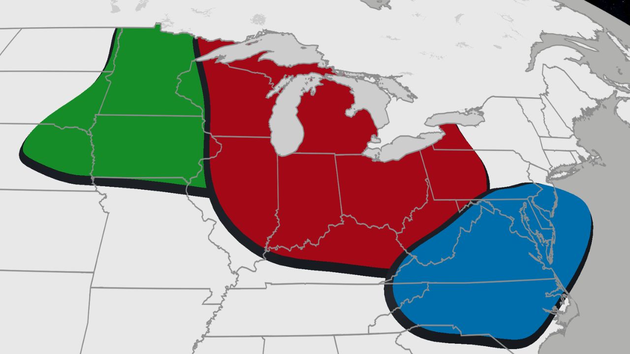
In addition to Chicago, cities including Indianapolis, Detroit, Cincinnati, and Pittsburgh are all expected to face an elevated risk of severe thunderstorms.
Forecasters warn that damaging wind gusts exceeding 75 mph and very large hail will be the primary threats. While widespread tornadoes are not expected, isolated tornadoes cannot be ruled out as storms develop and strengthen during the afternoon and evening.
The strongest storms are forecast to continue into Monday night and the overnight hours, potentially causing hazardous travel conditions, scattered power outages, and localized damage.
Storm Threat Expands Into the Mid-Atlantic Tuesday
The severe weather risk is expected to shift east on Tuesday, bringing another active day for millions across the mid-Atlantic.
According to forecasters, two separate rounds of thunderstorms are likely during the day.
The first round could develop during the morning, stretching from the upper Ohio Valley into parts of the mid-Atlantic. Some of these early storms may already be strong before a second, potentially more widespread round develops later in the day.
During the afternoon and evening, thunderstorms are expected to intensify and could affect major metropolitan areas including Washington, D.C., Philadelphia, Baltimore, Charlotte, and Raleigh.
Residents in these regions should monitor local forecasts, as severe weather timing may change depending on how the morning storms evolve.
Why Meteorologists Expect Storms to Intensify
Forecasters say several atmospheric ingredients are aligning to create a favorable environment for severe thunderstorms.
A significant heatwave is expanding across the Central Plains and Rocky Mountains, with some locations expected to challenge daily temperature records. Denver could climb into the triple digits, providing enormous amounts of energy for developing storms.
At the same time, an area of high pressure near the Gulf Coast is pushing warm, moisture-rich air far north into the central United States.
That moisture is reaching the jet stream, where strong changes in wind speed and direction—known as wind shear—help thunderstorms organize and become more intense.
When combined with daytime heating, increasing atmospheric instability, and a strengthening surface low-pressure system, these ingredients significantly increase the potential for severe weather across the region.
Weekend Storms Offer Preview of What’s Ahead
Meteorologists say the atmosphere has already demonstrated its potential.
On Saturday, powerful storms swept across parts of the Northern Plains, producing hail larger than 2 inches in diameter in parts of South Dakota.
The same storms also generated wind gusts ranging from 70 to 92 mph across portions of Nebraska, South Dakota, and Iowa, highlighting the destructive potential of the weather system now moving east.
Forecasters encourage residents in areas under the severe weather threat to stay alert for watches and warnings, review emergency plans, and have multiple ways to receive weather alerts as conditions can change rapidly.
Do you live in an area expected to be impacted by these storms? How are you preparing for the severe weather threat? Share your thoughts in the comments below.