Chicago, Illinois — A noticeable shift toward cooler, less humid weather is coming to the Midwest and interior Northeast this weekend, offering residents a brief taste of autumn after weeks of summer-like conditions.
A push of Canadian air is expected to spread across the Great Lakes and into the central and northern Appalachian region. The cooler weather should provide relief from the heat, but forecasters warn the temperature change will come with a potentially dangerous side effect: heavy rain and thunderstorms.
The weather pattern is expected to continue into early next week, potentially reducing demand for air conditioning and helping ease energy consumption and costs.
Temperatures Could Drop Into the 70s
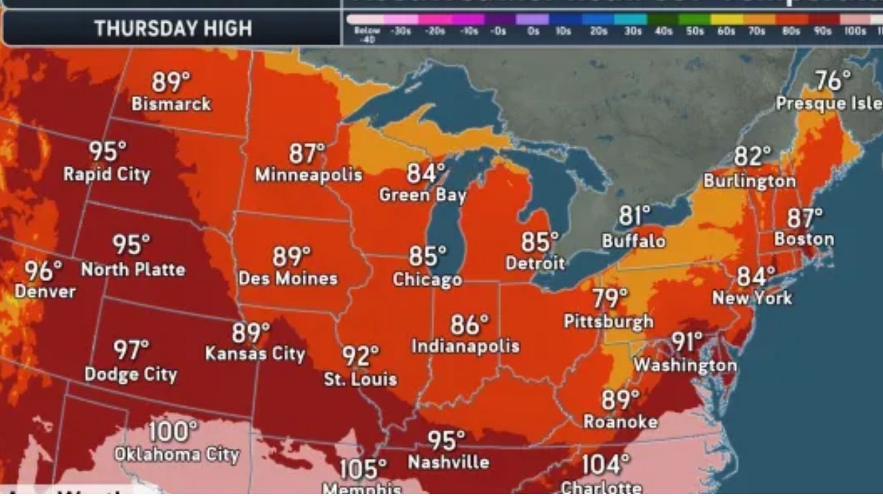
Instead of widespread temperatures in the 80s to near 90 degrees, which are common across the Midwest and Northeast during this part of summer, the incoming pattern should bring highs mainly in the 70s to low 80s.
The cooler conditions will become even more noticeable overnight. Where skies clear, temperatures could fall into the 50s, while some of the coolest locations may experience lows in the 40s.
Meteorologists say the eventual reach of the cooler air will depend heavily on the shape and strength of a dip in the jet stream. A deeper dip could push the cooler, drier air much farther south and east, potentially reaching portions of the Southeast.
However, if the jet stream dip remains sharply anchored farther inland, warm and humid air could linger along the Interstate 95 corridor, increasing the threat of heavy rain and severe thunderstorms.
Cooler Weather Could Trigger Strong Storms
The transition will not necessarily arrive as one powerful autumn cold front. Instead, cooler air is expected to slowly push southeastward, with successive waves moving into the region from Friday through early next week.
The contrast between the cooler air aloft and relatively warm conditions near the surface could create an unstable atmosphere around the Great Lakes.
Meteorologists warn that towering clouds, showers and gusty thunderstorms could develop, with some storms capable of producing small hail.
There is even a chance that some thunderstorms could generate waterspouts, particularly because lake water temperatures remain relatively warm.
Warm Atlantic Waters Could Fuel Heavy Rain
The weather threat will not be limited to the Great Lakes. Along the East Coast, warm Atlantic Ocean waters could slow the movement of the cooler air.
As the boundary between the two air masses stalls, it could become a focal point for repeated thunderstorms and periods of torrential rainfall.
Forecasters say the setup could produce flash flooding and severe thunderstorms, particularly across portions of the southern and Mid-Atlantic Seaboard.
The threat could also expand into parts of New England and toward the northeastern Gulf Coast depending on how the weather pattern evolves.
Several Major Cities Face Flooding Risk
Some locations could face a medium-to-high risk of torrential downpours and flash flooding during part of the weekend.
Cities specifically facing concern include Norfolk, Virginia; Salisbury, Maryland; Elizabeth City, North Carolina; Atlantic City, New Jersey; Washington, D.C.; and Philadelphia.
The risk could shift as the forecast becomes clearer.
Depending on the eventual position of the storm system and the stalled boundary, heavy rain could extend northward toward New York City and Boston.
Farther south, the threat could reach Myrtle Beach and Charleston, South Carolina; Savannah, Georgia; and Jacksonville, Florida.
Cooler Weather Comes With a Stormy Catch
The incoming pattern will provide welcome relief from summer heat for millions of people across the Midwest and Northeast, but forecasters are urging residents not to mistake cooler temperatures for quiet weather.
One or two rounds of gusty thunderstorms could accompany successive waves of cooler air, while areas along the stalled boundary could experience repeated downpours.
For communities in the flood-prone areas, the combination of slow-moving storms, torrential rain and already-warm waters could create dangerous conditions.
The exact reach of the cool air and the location of the heaviest rain will depend on how the jet stream evolves over the next several days.
For now, residents across the Great Lakes, Midwest, Mid-Atlantic and Northeast should prepare for a weekend that could feel more like early autumn than the heart of summer — with a significant storm threat arriving alongside the cooler air.
Are you ready for the cooler temperatures, or would you rather keep the summer heat around a little longer? Share your thoughts in the comments below.