Oklahoma City, Oklahoma — Millions of Americans across the central and eastern United States are facing another active week of severe weather as forecasters warn that the storm pattern responsible for repeated rounds of thunderstorms and flooding throughout June is showing little sign of weakening.
After producing widespread severe weather across parts of Wyoming, Colorado, and Kansas over the weekend, the same storm system is expected to continue tracking eastward, bringing renewed threats of damaging storms and heavy rainfall to communities already dealing with saturated ground and flooding concerns.
Meteorologists say the combination of abundant moisture, unstable air, and multiple storm systems will keep much of the country on alert through at least the end of the week.
Severe Storm Threat Shifts Into the Midwest
Following Saturday’s outbreak of severe thunderstorms across portions of the central Plains, the focus is shifting toward the Midwest.
Communities stretching from Oklahoma City to St. Louis are expected to face additional rounds of thunderstorms capable of producing dangerous weather conditions.
The primary hazards include:
- Damaging wind gusts
- Large hail
- Flash flooding
- Isolated tornadoes
Many of these areas have already experienced multiple rounds of severe weather and flooding this month, increasing concerns about additional impacts from repeated storms.
Forecasters warn that some locations could see heavy rainfall in a short period of time, creating localized flooding issues on roads and in low-lying areas.
East Coast Faces Storm Threat Early in the Week
As the storm system pushes eastward on Monday, the severe weather threat is expected to expand toward major population centers along the Interstate 95 corridor.
Cities from Raleigh, North Carolina, to Philadelphia, Pennsylvania, could experience strong thunderstorms capable of disrupting travel and producing localized flash flooding.
In addition to the main storm system, a cold front extending from the Mid-Atlantic through the South and back into the Plains will provide another trigger for storm development.
Meteorologists say multiple rounds of thunderstorms may develop along this boundary, increasing rainfall totals in some areas. Travelers and commuters in affected regions are being urged to monitor weather updates and remain alert for rapidly changing conditions.
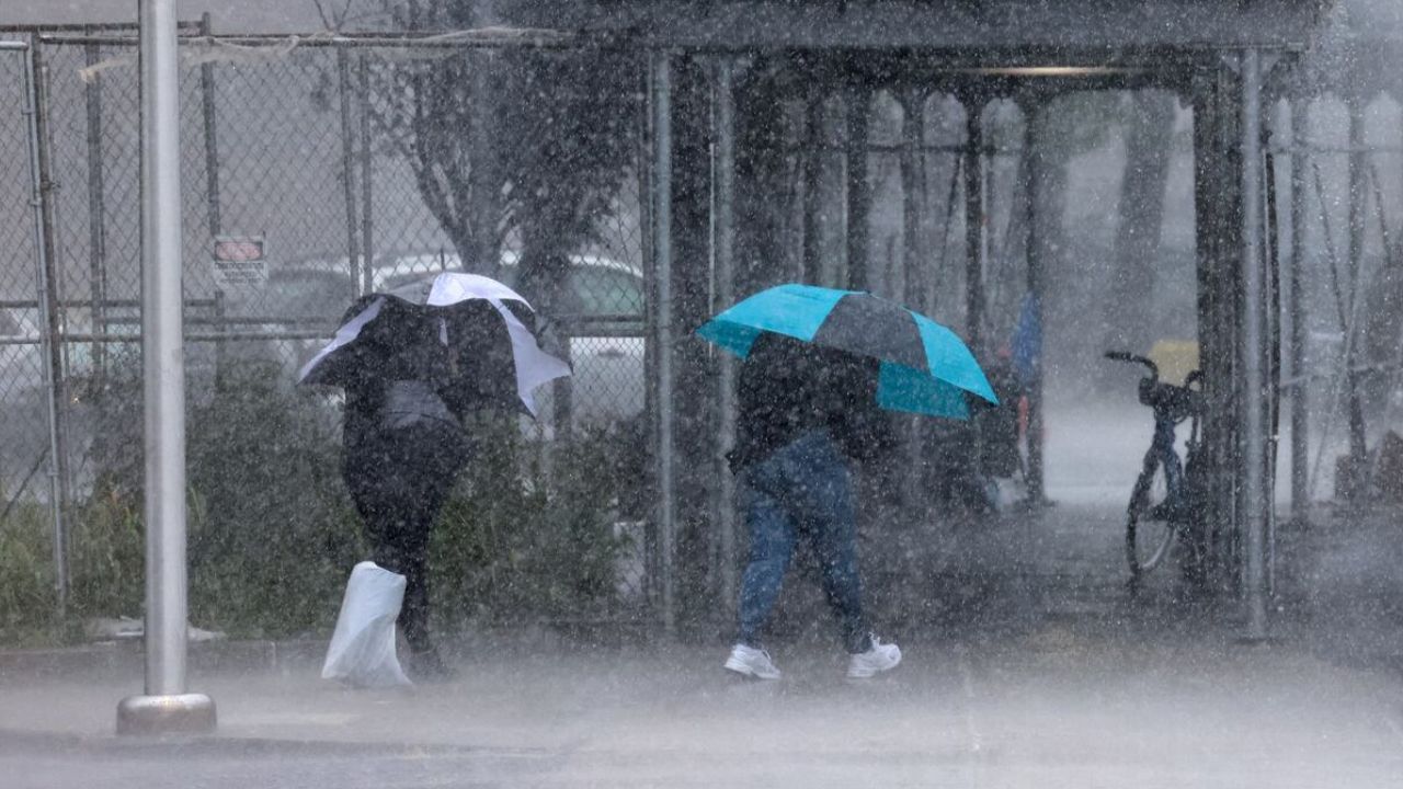
Flooding Concerns Growing Across the South
One of the biggest concerns this week remains the potential for flash flooding.
Several southern states have already received significant rainfall from recent thunderstorm activity and moisture associated with the remnants of former Tropical Storm Arthur.
Because many areas remain saturated, it may take only a relatively small amount of additional rain to create new flooding problems.
Rivers, streams, drainage systems, and low-lying roadways could become overwhelmed quickly if repeated storms move over the same locations.
Emergency officials continue encouraging residents to avoid flooded roadways and heed any flood warnings issued by local authorities.
Plains Expected to See Daily Storm Chances
By Tuesday and continuing through the middle of the week, attention will shift back toward the Plains.
A series of disturbances moving out of the Rocky Mountains will interact with warm, moisture-rich air, creating favorable conditions for repeated thunderstorm development.
Risk areas are expected to extend across:
- Eastern Colorado
- Nebraska
- Kansas
- Oklahoma Panhandle
- Texas Panhandle
Forecasters say large hail and damaging winds will be the primary threats, although some storms could become particularly intense.
Not every community will experience severe weather, but the overall pattern supports multiple opportunities for strong storms throughout the region.
Storm Coverage Expected to Expand Later This Week
The severe weather threat could become even more widespread by Thursday as another round of storms develops across a larger portion of the Plains.
Current forecasts indicate the risk area may stretch from the Oklahoma City metro area northward into parts of eastern Montana. Damaging winds, hail, and heavy rainfall are expected to remain the primary hazards.
Because many locations could experience multiple rounds of rain during the week, flooding concerns may continue to increase, particularly in communities that repeatedly find themselves under thunderstorm activity.
With no major pattern change expected in the near term, forecasters are urging residents across the central and eastern United States to stay weather-aware and prepare for the possibility of severe storms throughout the week.
Has your area experienced severe weather or flooding recently? What preparations do you take when repeated storms are in the forecast? Share your thoughts and experiences in the comments below.