Omaha, Nebraska — A new round of severe weather is expected to sweep across the central United States this weekend, bringing the threat of damaging thunderstorms, tornadoes, large hail, and expanding flooding concerns from the High Plains to the Ohio Valley.
The storm system arrives after a brief lull in severe weather activity following a powerful outbreak earlier in the week that generated nearly 300 severe weather reports, including damaging winds and multiple tornadoes across parts of the Plains and Midwest.
Forecasters say the next wave of storms could impact millions of residents as conditions become favorable for widespread severe weather through early next week.
Severe Thunderstorms Expected Across the Plains
As a developing storm system emerges from the Rocky Mountains, thunderstorms are forecast to rapidly intensify across portions of the High Plains on Saturday.
The broad severe weather zone is expected to stretch from southeastern Wyoming and eastern Colorado through Nebraska, Kansas, western Missouri, and southwestern Iowa, while also reaching parts of the Oklahoma and Texas Panhandles.
Meteorologists say the most intense storms could initially develop as isolated supercells capable of producing large hail, tornadoes, and destructive wind gusts.
A more concentrated corridor of severe weather is expected from northeast Colorado into central Nebraska and eastern Kansas.
Forecasters warn that some storms may produce wind gusts approaching 90 mph, creating the potential for widespread damage to trees, power lines, and structures.
As the evening progresses, individual storms are expected to merge into larger storm complexes capable of traveling long distances while maintaining damaging wind threats.
Storm Threat Expands Eastward on Sunday
The severe weather risk will continue shifting eastward as the weekend progresses.
By Sunday, the threat area is expected to extend from eastern Colorado across the central Mississippi Valley and into parts of Ohio and West Virginia.
Communities throughout the Ohio Valley could face damaging straight-line winds, large hail, and isolated tornadoes as the storm system advances.
Some severe weather may even reach portions of the eastern United States by Monday. Residents across multiple states are being encouraged to monitor forecasts closely as weather conditions evolve.
Heavy Rain Raises Flooding Concerns
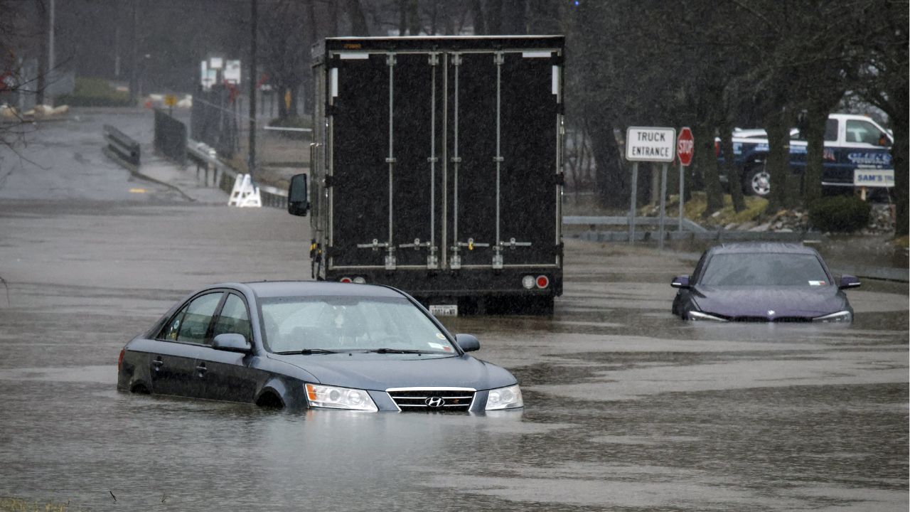
While many areas across the central United States have benefited from recent rainfall that eased drought conditions, the persistent storms have also created new flooding problems.
Several rivers across the region remain elevated, including portions of the Illinois, Wabash, and Mississippi rivers, where flooding has already been reported.
Additional rounds of heavy rain are expected to worsen those concerns.
Forecast models indicate widespread rainfall totals between 1 and 4 inches, with some communities potentially receiving up to 6 inches of rain by early next week.
The combination of saturated soils and repeated downpours could lead to flash flooding, overflowing streams, and rising river levels.
Flood Risk Shifts Toward the South and East
As the storm system moves farther east, heavy rainfall is expected to spread into the Ohio Valley, Tennessee Valley, Ozarks, and southern Appalachian region.
Areas of Arkansas, Georgia, North Carolina, Virginia, and West Virginia may experience periods of torrential rainfall capable of triggering flash flooding.
Forecasters say locations that have already received significant rainfall in recent weeks will be especially vulnerable.
Louisiana Town Sees Over 29 Inches of Rain, Weather Experts Warn More Rain Could Be on the Way
Urban flooding and rapidly rising creeks could develop in areas where thunderstorms repeatedly move over the same locations. The Northeast may also receive beneficial rainfall, although isolated flooding in low-lying and urban areas remains possible.
Gulf Coast States Continue to Recover From Extreme Rainfall
Flood concerns are not limited to the Plains and Midwest.
Additional heavy rain is forecast from parts of Texas through the Gulf Coast and into the Southeast as weak areas of low pressure move across the region.
Some communities are still recovering from extraordinary rainfall associated with Tropical Storm Arthur.
One of the most remarkable reports came from Cottonport, Louisiana, where more than 31 inches of rain was reportedly measured, with most of it falling within a 24-hour period.
Meteorologists say some rainfall records may have been broken across several Gulf Coast states.
With multiple weather systems affecting the country simultaneously, forecasters are urging residents to remain alert for changing conditions and potential flood warnings throughout the coming days.
Is your area expecting severe weather or heavy rain this weekend? How are you preparing for possible storms and flooding? Share your thoughts and experiences in the comments below.